

ISTER PROJECT
The ISTER project set out to rediscover and revive the network of roads and settlements along the Danube founded and developed by the Romans 2000 years ago. The aim was to create eco-friendly routes between them with a view to reviving the local economy, connecting communities with their heritage, and reinvigorating previously neglected areas.
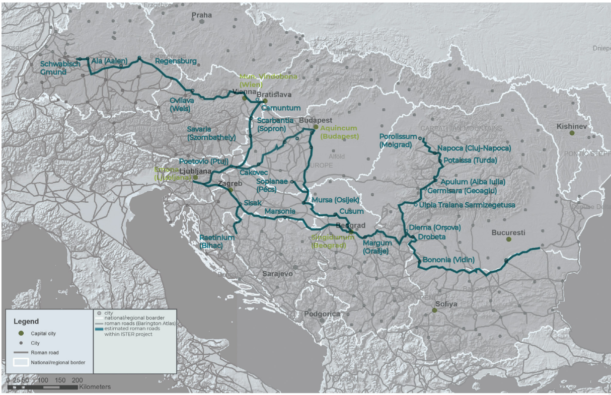
Map of the Roman road network explored as part of the ISTER project, showing our partner sites. © ISTER project
Modern-day Slovenia lies at the crossroads of the Alps and the Balkans and the Baltic and the Black Sea, and there were already several caravan routes across it in prehistoric times, their importance reflected in the legends preserved by ancient scribes. One important trade route, which connected Slovenia with the Baltic, was named the “Amber Route” after the precious cargo transported along it.
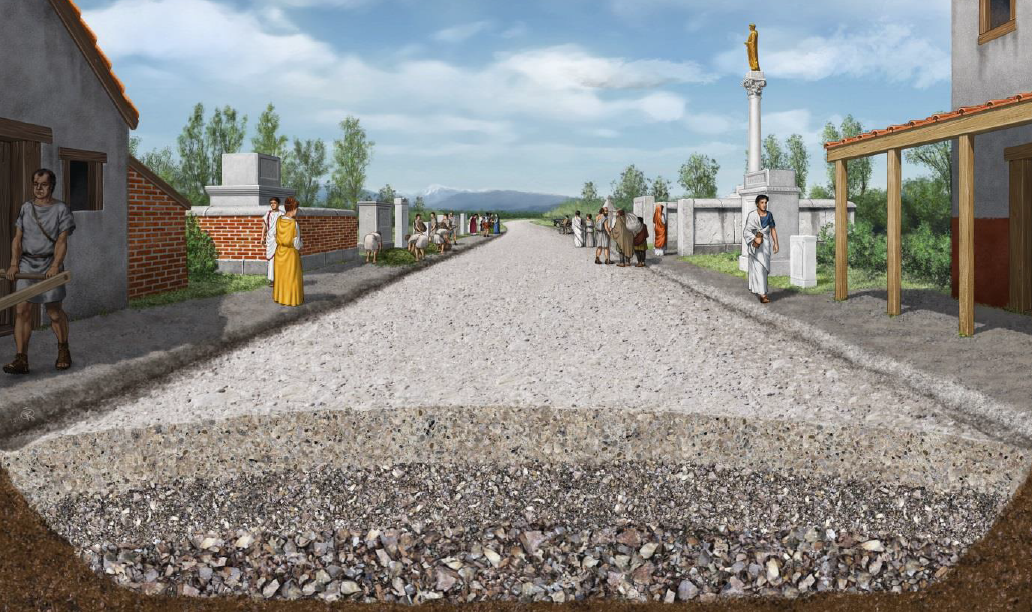
The construction of the road linking the Italic region (present-day Italy) with central Slovenia and onwards to the east was of key strategic importance for the Roman conquest of the regions between the Sava and the Danube at the end of the first century BC. The road began in Aquileia, but the ISTER project team at Ljubljana City Museum focused on the section between Fluvius Frigidus/Castra (Ajdovščina) and Emona (Ljubljana) and onwards to Atrans (Trojane). From there the road passed through Celeia (Celje) and Poetovio (Ptuj) before continuing to Carnuntum (Petronell, near Vienna) and Aquincum (Budapest).
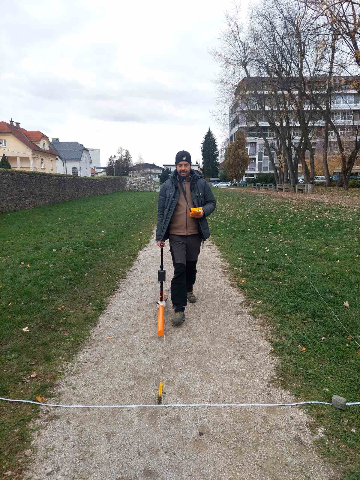
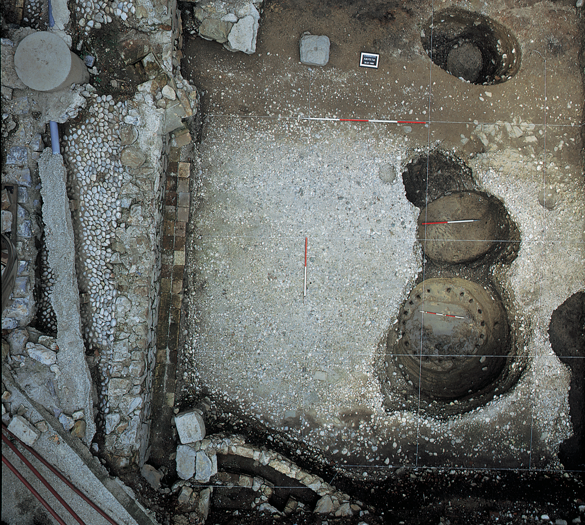
As part of the ISTER project and in partnership with colleagues from the Centre for Preventive Archaeology at the Institute for the Protection of the Cultural Heritage of Slovenia, we carried out GPR surveys of the southern part of Emona to learn more about the roads within and just outside the city walls. Photo: Bernarda Županek/MGML
ROMAN ROAD BETWEEN CASTRA (AJDOVŠČINA) AND ATRANS (TROJANE)
For the purposes of the ISTER project we followed the Roman road heading east from Aquileia, beginning our research just the other side of the border with Italy. The road first took us to Fluvius Frigidus/Castra (Ajdovščina), a fortified settlement just before the ascent to Col; Ad Pirum (Hrušica) followed, then the fortress at Lanišče, and from there we passed through Logatec to Nauportus (Vrhnika). From here, people and cargo could either be transported to Emona (Ljubljana) via the Ljubljanica River, or they could continue along the road on foot, on horseback or by chariot, along the edge of the Marshes. From Emona, our road continued to Atrans (Trojane), an important customs post. All these Roman settlements have been signposted as part of the ISTER project.
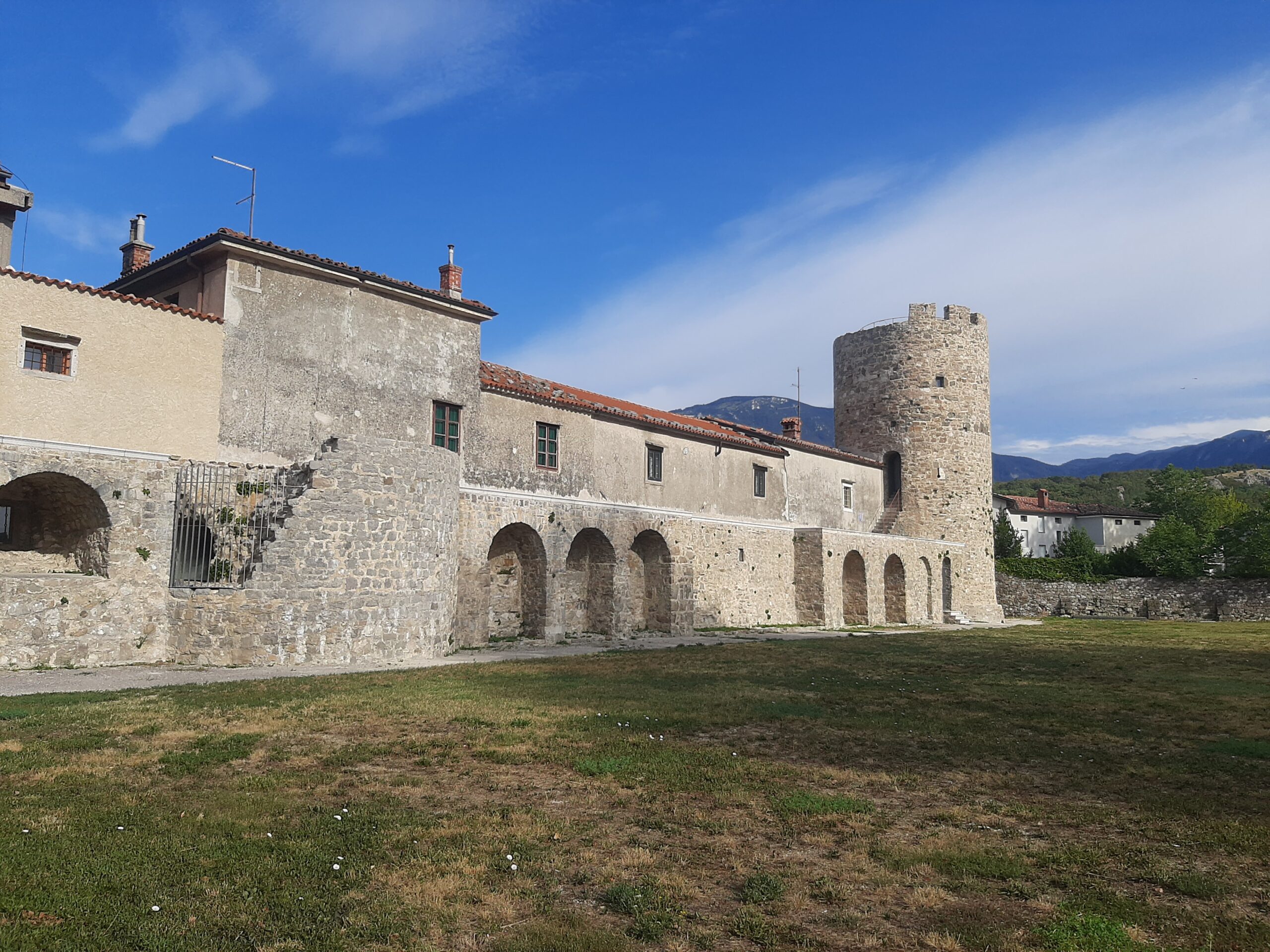
Remains of the walls of the Castra fortress (present-day Ajdovščina). Photo: Nuša Videc/MGML
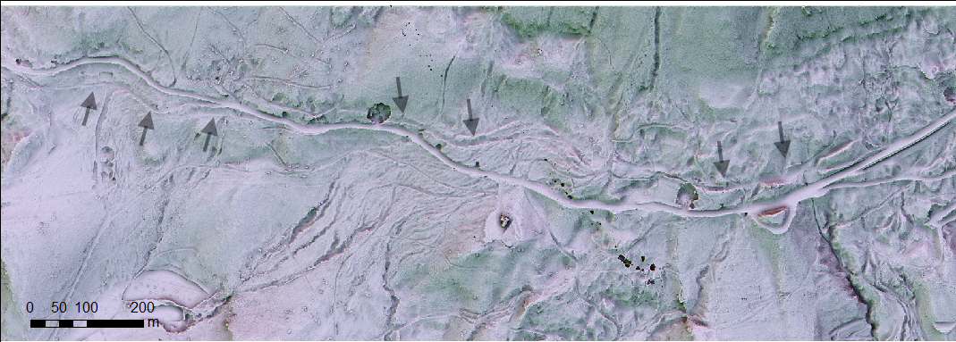
Lidar image of the Augustan road from Aquileia to Emona, near the present-day village of Col. Image: Dimitrij Mlekuž/Preventive Archaeology Centre, Institute for the Protection of the Cultural Heritage of Slovenia
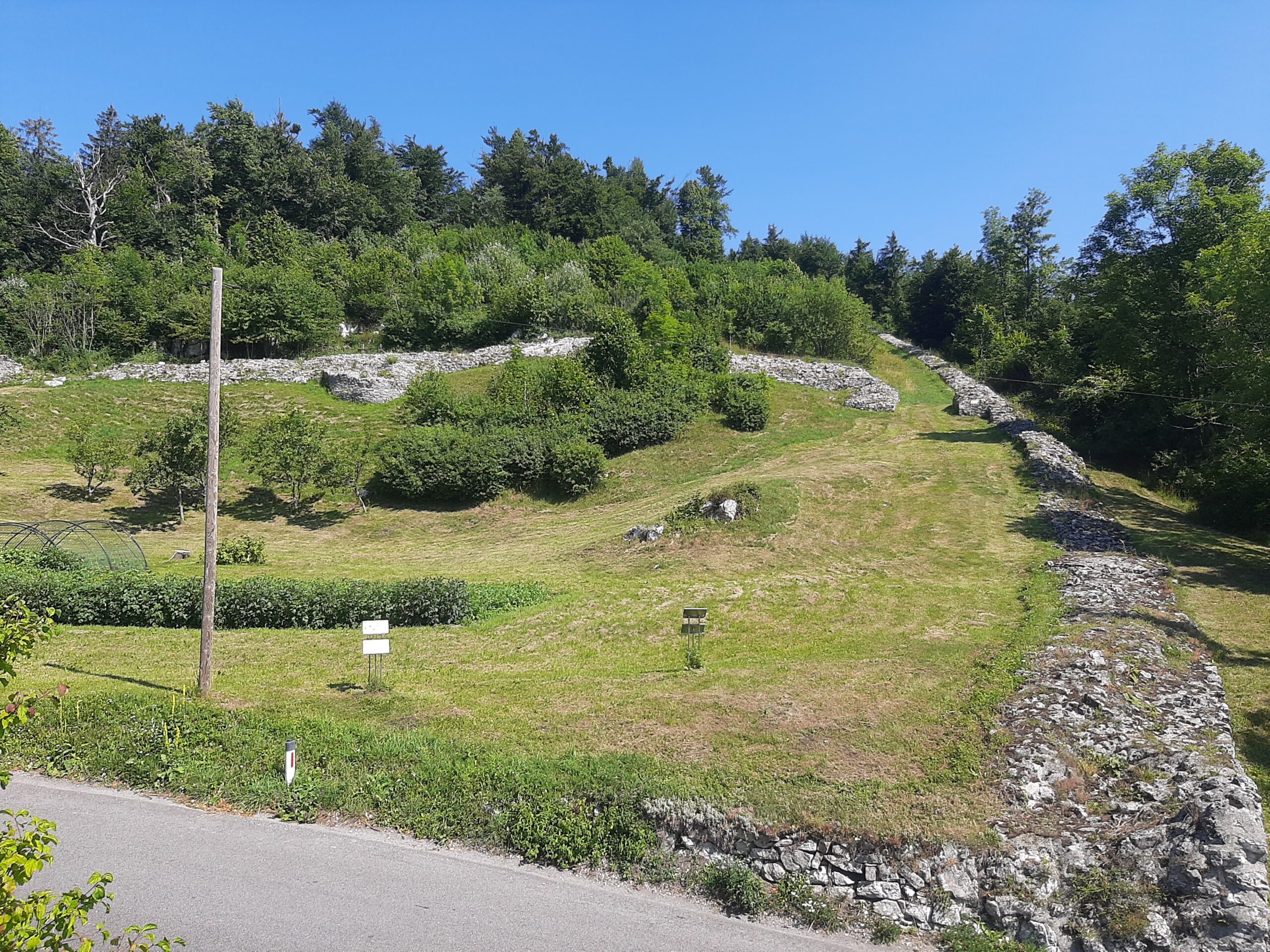
The Aquileia-Emona road went past the fortresses at Ad Pirum (present-day Hrušica) and Lanišče. Photo: Nuša Videc/MGML

The Aquileia-Emona road went past the fortresses at Ad Pirum (present-day Hrušica) and Lanišče. Photo: Nuša Videc/MGML
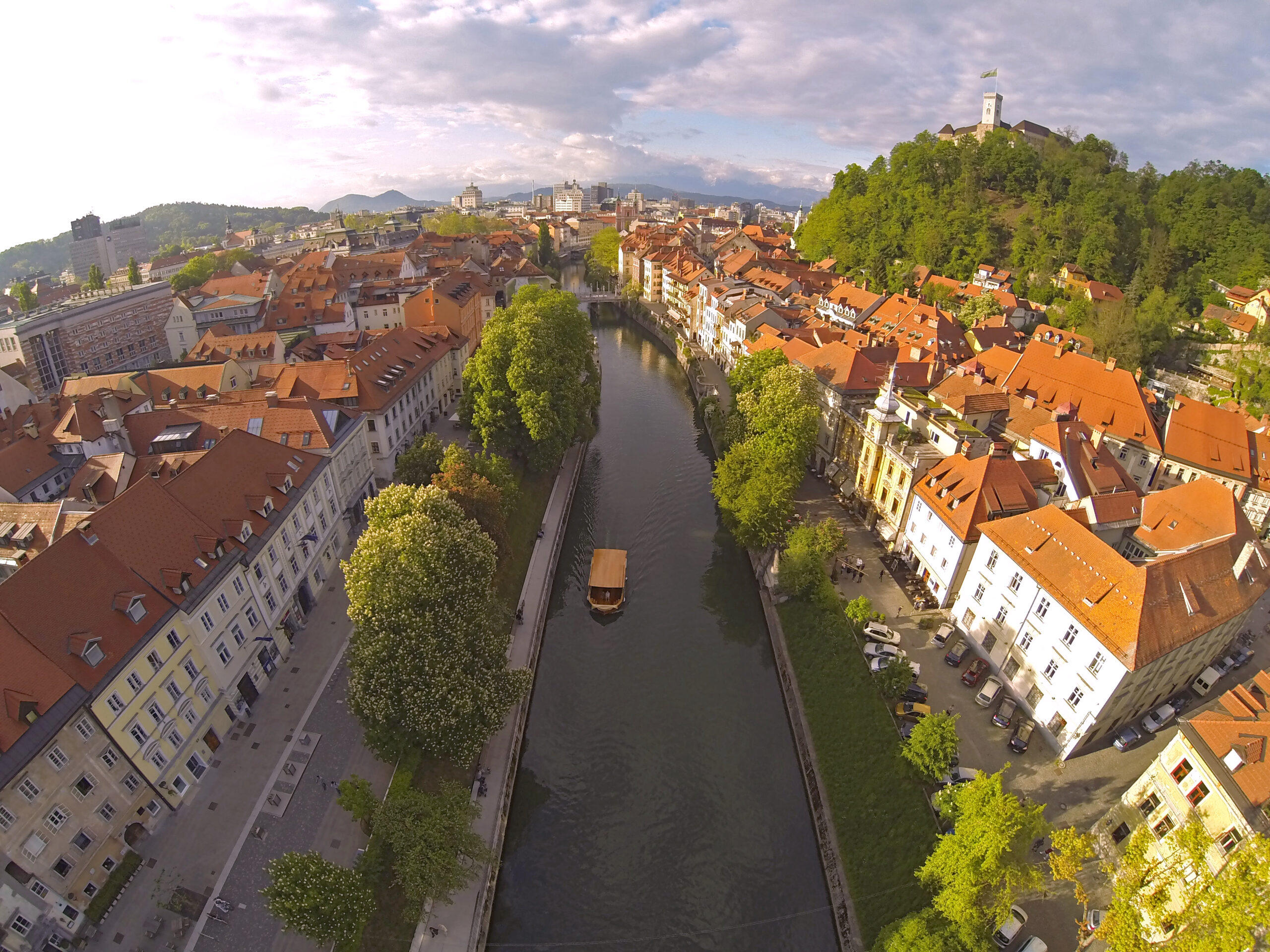
The Ljubljanica River in today’s Ljubljana. Even in prehistoric times, this waterway was a key means of transporting people and goods between Nauportus (Vrhnika) and Emona (Ljubljana). Photo: Aarstudio, Mostphotos
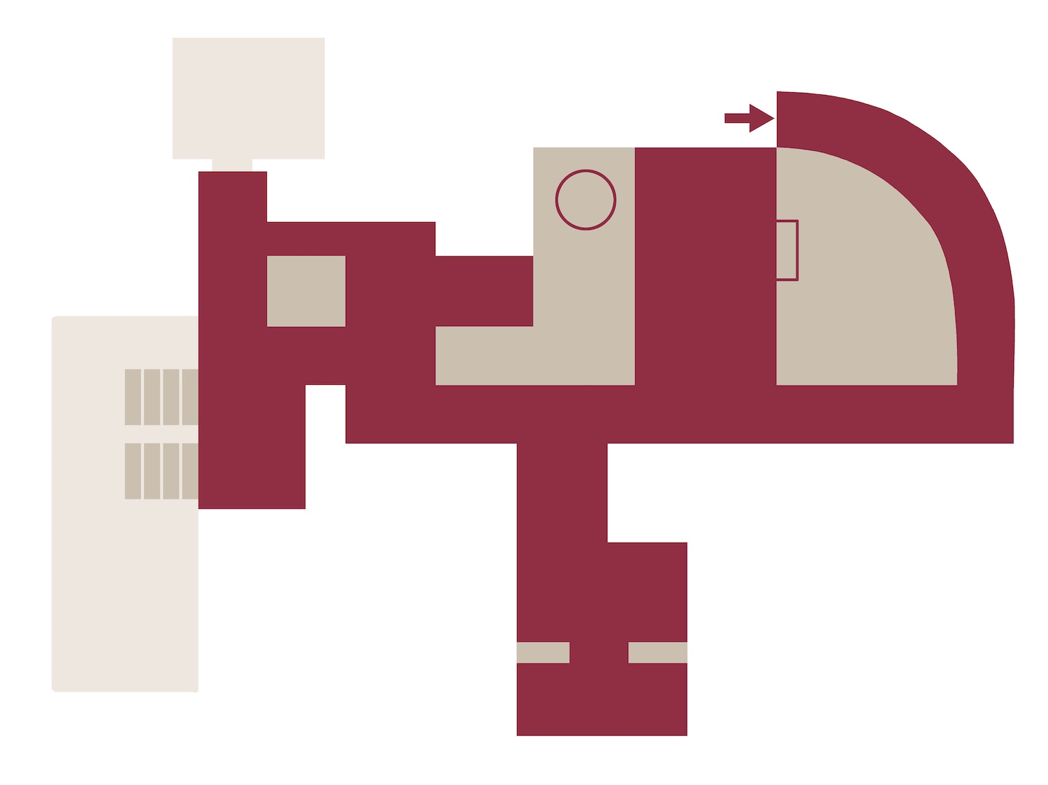
The remains of Emona in the modern Ljubljana are connected into Archaeological park Emona. Author: Bojan Lazarević, Agora, d. o. o./MGML.
The northern road to/from Emona was flanked by an extensive cemetery on both sides. Image: Igor Rehar/MGML
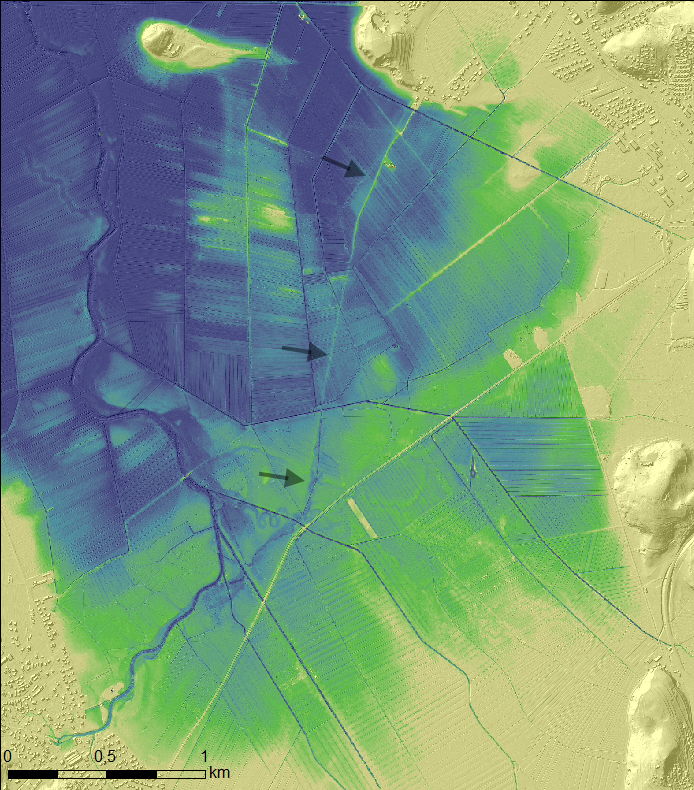
Some stretches of road in the wider Emona area were absolutely straight. The road through the challenging marshland between Babna gorica and Ig was one of them, as can be seen from the lidar image. Image: Dimitrij Mlekuž/Preventive Archaeology Centre, Institute for the Protection of the Cultural Heritage of Slovenia
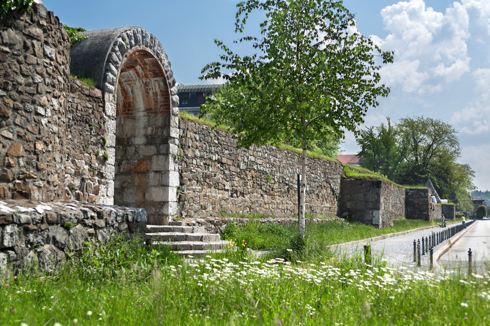
Roads connected nodes of Romanness in the landscape: towns, monuments, temples, plots of land. The image shows the remains of the monumental southern section of the Emona city wall. Photo: Andrej Peunik/MGML
Remains of the walls of the Castra fortress (present-day Ajdovščina). Photo: Nuša Videc/MGML
Lidar image of the Augustan road from Aquileia to Emona, near the present-day village of Col. Image: Dimitrij Mlekuž/Preventive Archaeology Centre, Institute for the Protection of the Cultural Heritage of Slovenia
The Aquileia-Emona road went past the fortresses at Ad Pirum (present-day Hrušica) and Lanišče. Photo: Nuša Videc/MGML
The Aquileia-Emona road went past the fortresses at Ad Pirum (present-day Hrušica) and Lanišče. Photo: Nuša Videc/MGML
The Ljubljanica River in today’s Ljubljana. Even in prehistoric times, this waterway was a key means of transporting people and goods between Nauportus (Vrhnika) and Emona (Ljubljana). Photo: Aarstudio, Mostphotos
The remains of Emona in the modern Ljubljana are connected into Archaeological park Emona. Author: Bojan Lazarević, Agora, d. o. o./MGML.
The northern road to/from Emona was flanked by an extensive cemetery on both sides. Image: Igor Rehar/MGML
Some stretches of road in the wider Emona area were absolutely straight. The road through the challenging marshland between Babna gorica and Ig was one of them, as can be seen from the lidar image. Image: Dimitrij Mlekuž/Preventive Archaeology Centre, Institute for the Protection of the Cultural Heritage of Slovenia
Roads connected nodes of Romanness in the landscape: towns, monuments, temples, plots of land. The image shows the remains of the monumental southern section of the Emona city wall. Photo: Andrej Peunik/MGML
| Hiperpovezave | |
|---|---|
| The ISTER project: |  |
| Ljubljana tourist information: |  |
| ISTER project map of Roman monuments, milestones and routes: |  |
| Experience Roman cuisine under the stars by the Adriatic: |  |
| Roman Games, Ptuj, every August: see Roman soldiers, get a taste of everyday life, cuisine and rituals in the Roman Empire, and watch a gladiator fight. |  |
| For an outdoor experience, explore the remains of the once-mighty Roman defence system at Claustra: |  |
| Walk the Rakitna Archaeological Trail near Ljubljana: |  |
| For those who’d like to delve a little more deeply, the annual Festival of Antiquity sheds new light on a theme connected with the ancient past. |  |
| Want to cook like a Roman? Try out some recipes from the Roman cook, Apicius. |  |
| A short overview of Emona and a virtual walk to some of the most interesting parts of Roman city: |  |
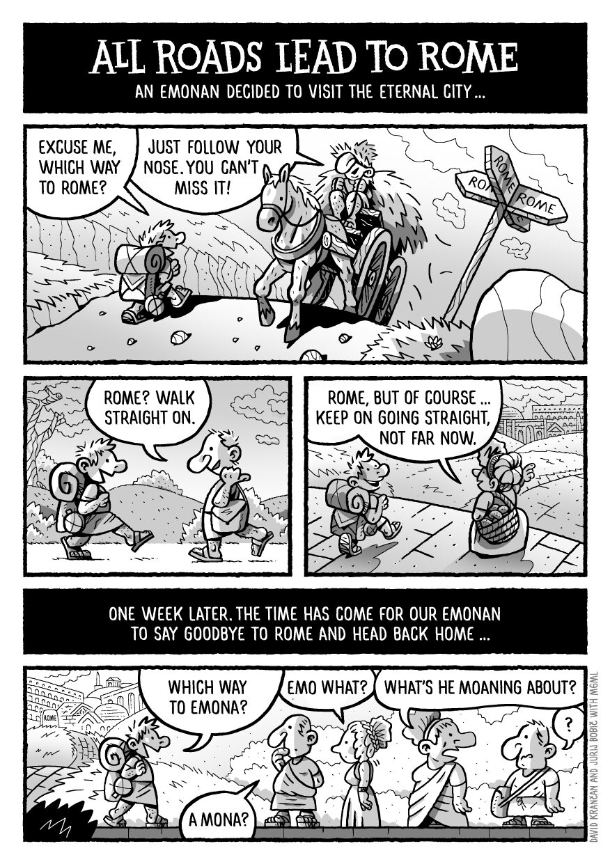
All Roads Lead to Rome. Image: David Krančan, Jurij Bobič/MGML